The Durupınar Boat-Shaped Formation
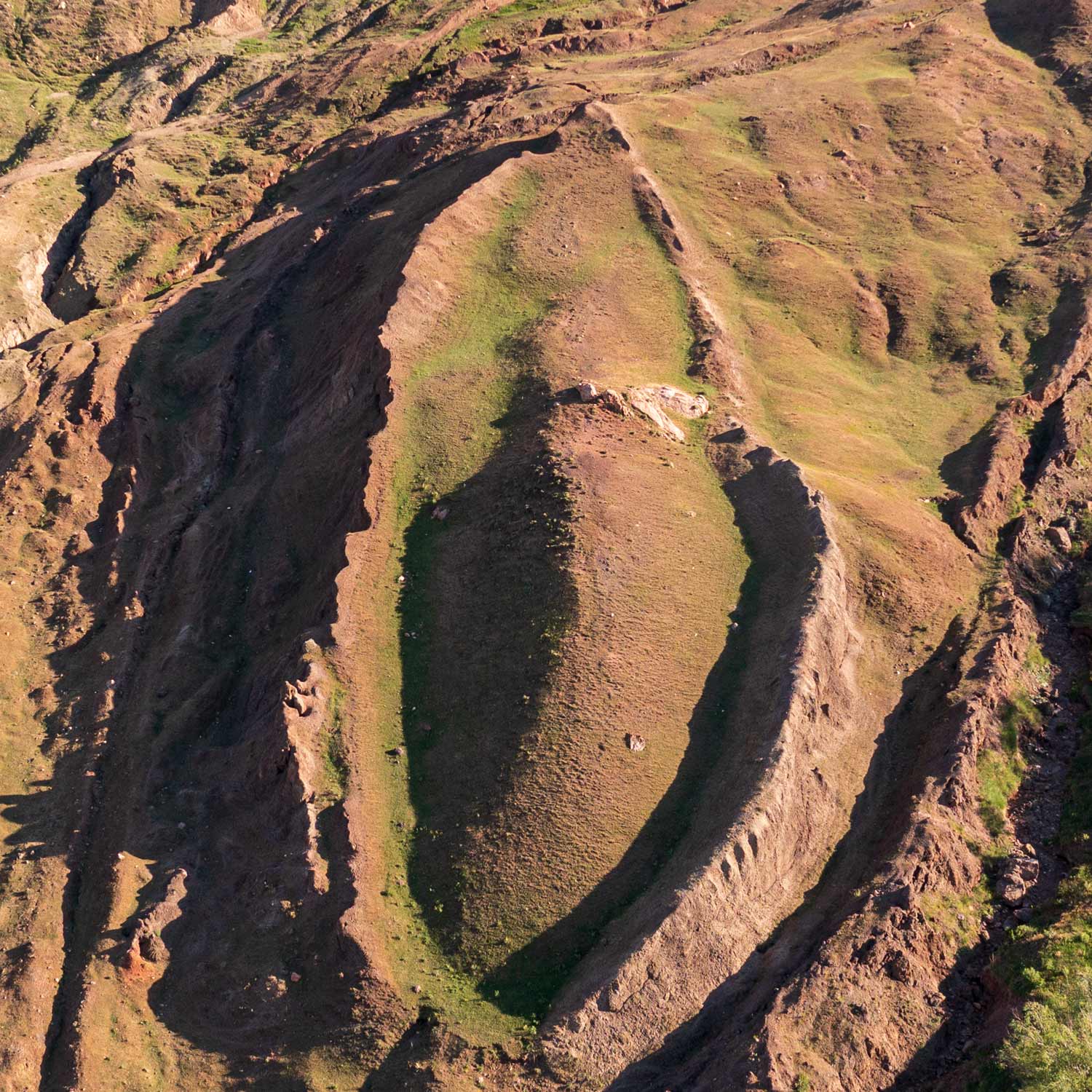
Resting at 6,300 feet in the Tendürek foothills of the Ararat mountain range, the Durupınar formation exhibits an unmistakable ship hull contour emerging from ancient volcanic mudflows.
 2019 Drone Survey
Click to Zoom
2019 Drone Survey
Click to Zoom
High-Resolution Aerial Overview
The symmetrical hull formation stands out prominently against surrounding mudflows. Notice the pointed prow, rounded stern, and double-walled perimeter outlining the ship's outer timbers.
 Structural Survey
Click to Zoom
Structural Survey
Click to Zoom
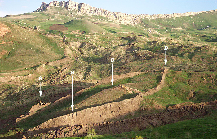
Hull Integrity & Key Points
Points (A) and (D) mark the longitudinal extremities measuring exactly 515 feet. Points (B) and (C) highlight the longitudinal deck joists and vertical support ribs exposed by erosion.
 Classic Field Survey
Click to Zoom
Classic Field Survey
Click to Zoom
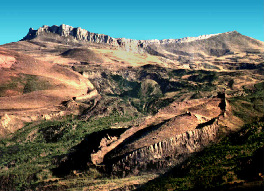
Non-Natural Geometry
Geologists confirm this formation does not conform to surrounding rock layers. The vessel was impaled on an outcropping of limestone as it drifted down the mountainside in a mudflow.
 Ron Wyatt Expedition
Click to Zoom
Ron Wyatt Expedition
Click to Zoom
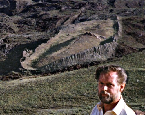
24 Years of Field Research
Beginning in 1977, nurse-anesthetist and explorer Ron Wyatt made dozens of expeditions to the site, conducting metal detection grids, subsurface radar scans, and core sampling.
 Satellite Analysis
Click to Zoom
Satellite Analysis
Click to Zoom
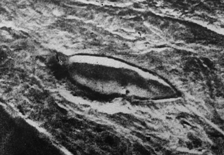
Visible from Orbit
The hydrodynamic shape is clearly identifiable on satellite photography, contrasting sharply with the natural dendritic drainage patterns of the surrounding topography.
The 515-Foot Length & Royal Egyptian Cubit
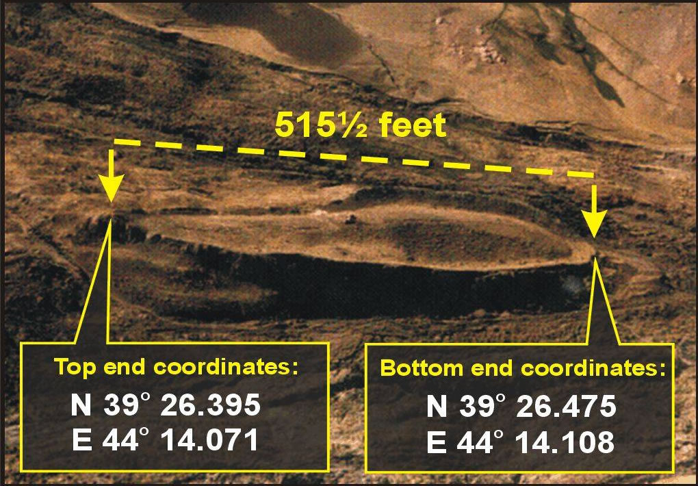
Critics often claimed the Durupınar formation was too long at 515 feet compared to common 18-inch Hebrew cubits. But historical context reveals a stunning mathematical precision.
 515.5 Feet Exact
Click to Zoom
515.5 Feet Exact
Click to Zoom
GPS Coordinates & Exact Metrics
Ron Wyatt measured the formation at 512 feet plus 3 feet for the displaced stern section = 515 feet. Satellite GPS surveys verified: Top End N 39° 26.395', E 44° 14.071' to Bottom End N 39° 26.475', E 44° 14.108'.
The Royal Egyptian Cubit Solution
Moses wrote the book of Genesis. The Bible records in Acts 7:22 that "Moses was educated in all the wisdom of the Egyptians." The standard unit of linear measurement in ancient Egypt was the Royal Egyptian Cubit, measuring 20.62 inches (0.524 meters).
6,186 ÷ 12 inches/foot = 515.5 Feet!
6:1 Naval Stability Ratio: The Ark's 300 cubit length by 50 cubit width constitutes an exact 6-to-1 ratio. Modern naval architects recognize 6:1 as the optimum hull ratio for maximum stability against capsizing in turbulent deep-sea storm swells.
Subsurface Radar Scans (GSSI SIR-3)
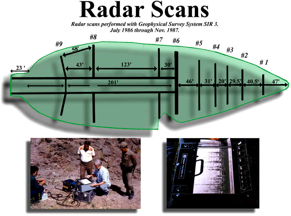
Ground-penetrating radar surveys conducted over the formation revealed a symmetrical, periodic internal structure with decks, bulkheads, and passageways impossible in natural geology.
 GSSI SIR-3 Radar
Click to Zoom
GSSI SIR-3 Radar
Click to Zoom
Geophysical Survey Systems Inc.
Radar scans performed between July 1986 and November 1987 revealed longitudinal walls (#1 through #9), 201-foot central corridors, 123-foot transverse bulkheads, and three distinct horizontal deck levels inside the hull.
 Cross-Section Diagram
Click to Zoom
Cross-Section Diagram
Click to Zoom
Internal Deck Joists & Rib Timbers
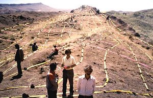
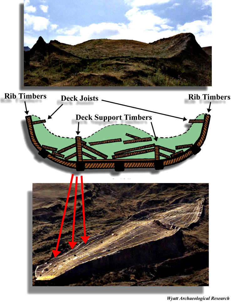
The cross-sectional radar profiles demonstrate outer rib timbers, deck support posts, and collapsed internal deck joists. Colored survey tapes laid on the ground matched the subsurface radar signatures with millimeter accuracy.
Galbraith Laboratories & Petrified Ribs
Independent chemical and microscopic testing proves the material is petrified biological timber rather than geological rock, supported by metallurgy showing hand-forged alloy brackets and rivets.
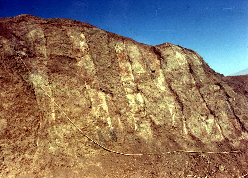 Exposed Timbers
Click to Zoom
Exposed Timbers
Click to Zoom
Vertical Rib Timbers
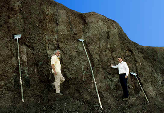
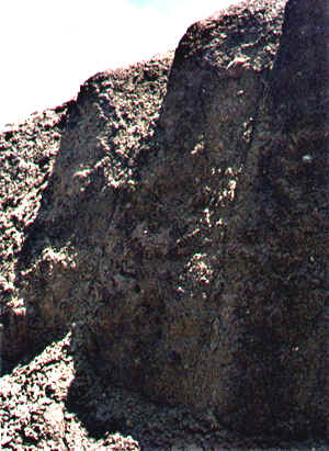
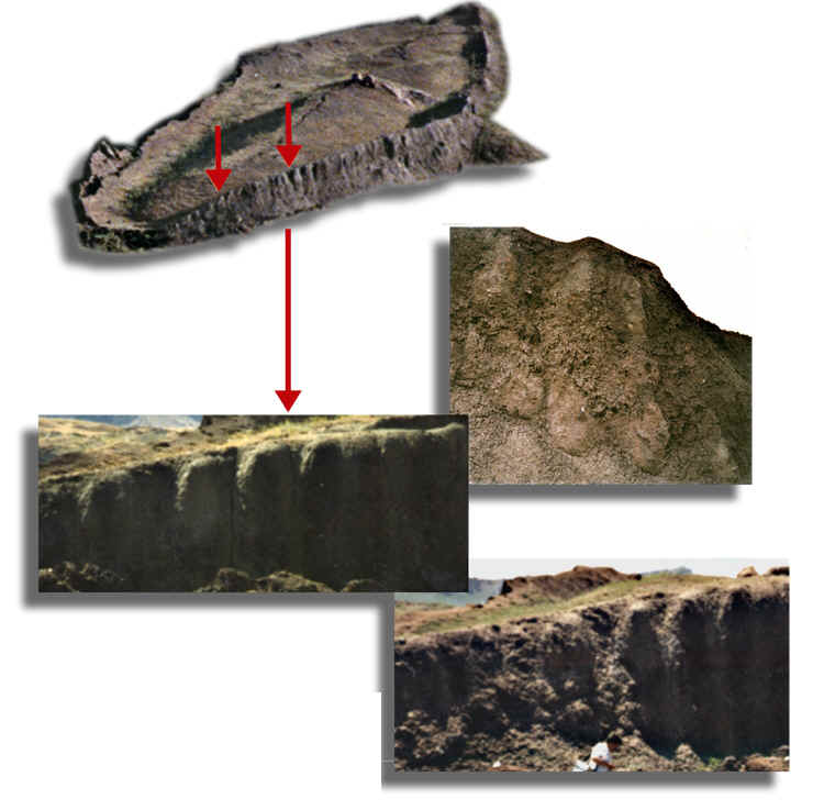
Following the 1978 earthquake, surrounding soil fell away, revealing vertical petrified structural timbers spaced systematically at 2.5 to 3-foot intervals along the exterior hull.
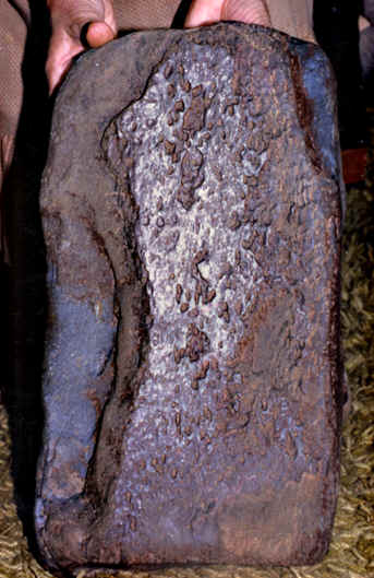 Excavated Specimen
Click to Zoom
Excavated Specimen
Click to Zoom
Laminated Wood with Pitch
Excavated specimen showing 3 distinct laminated layers joined with an organic tree pitch/resin adhesive—matching Genesis 6:14: "cover it inside and out with pitch."
 Official Decree 1987
Click to Zoom
Official Decree 1987
Click to Zoom
Turkey's Official Decree
On June 21, 1987, Turkey's national newspaper Hürriyet reported: "Nuhun Gemisi turizme açıldı" (Noah's Ark Opened to Tourism). The Turkish government formally dedicated Noah's Ark National Park.
The Giant Drogue Anchor Stones of Kazan
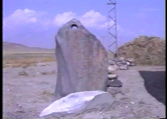
In the nearby mountain village of Kazan (Arzap), multiple massive multi-ton stone anchors were found, standing over 10 feet tall with drilled hawser rope holes.
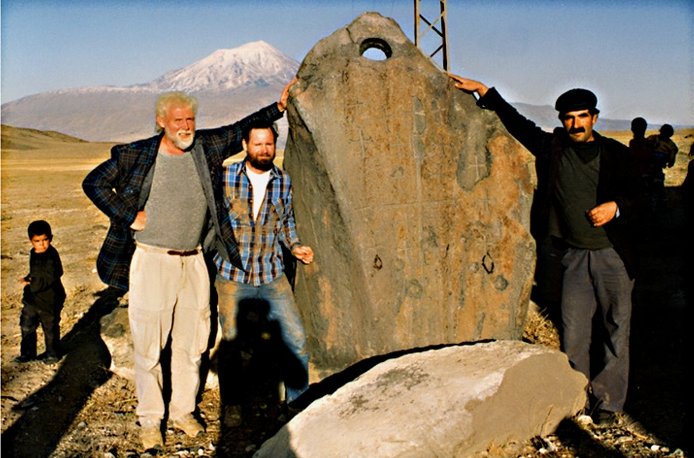 10-Ton Drogue Stone
Click to Zoom
10-Ton Drogue Stone
Click to Zoom
Massive Nautical Drogue Stones
Standing over 10 feet tall and weighing 8 to 10 tons, these stones were suspended on heavy ropes from the stern of the vessel. In ancient marine engineering, drogue stones acted as sea anchors to hold the bow into raging storm waves.
 Byzantine Cross Inscriptions
Click to Zoom
Byzantine Cross Inscriptions
Click to Zoom
Eight Byzantine Cross Carvings
Early Byzantine-era Christian pilgrims carved 8 crosses onto the anchor stones to commemorate the 8 persons saved aboard the Ark: Noah, his wife, their three sons (Shem, Ham, Japheth), and their three wives (1 Peter 3:20).
 Field Survey
Click to Zoom
Field Survey
Click to Zoom
Discovered in Kazan (Arzap)
Kazan translates to "Place of the Eight" in ancient regional tradition, marking where Noah severed the anchor lines as waters receded.
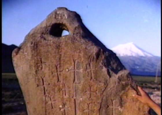 Rope Aperture
Click to Zoom
Rope Aperture
Click to Zoom
Drilled Hawser Aperture
The holes are precision-bored and chamfered at the edges to prevent thick mooring cables and hemp ropes from abrading and severing under tension.
 Pilgrim Inscription
Click to Zoom
Pilgrim Inscription
Click to Zoom
Ancient Pilgrim Landmark
The presence of these stones thousands of feet above sea level in inland mountains confirms the historical presence of a massive ocean-going vessel.
Why the Ark is NOT on Mt. Ararat Summit
For centuries, expeditions searched the 17,000-foot volcanic summit of Mount Ararat. Geological reality and biblical exegesis demonstrate why this traditional assumption is flawed.
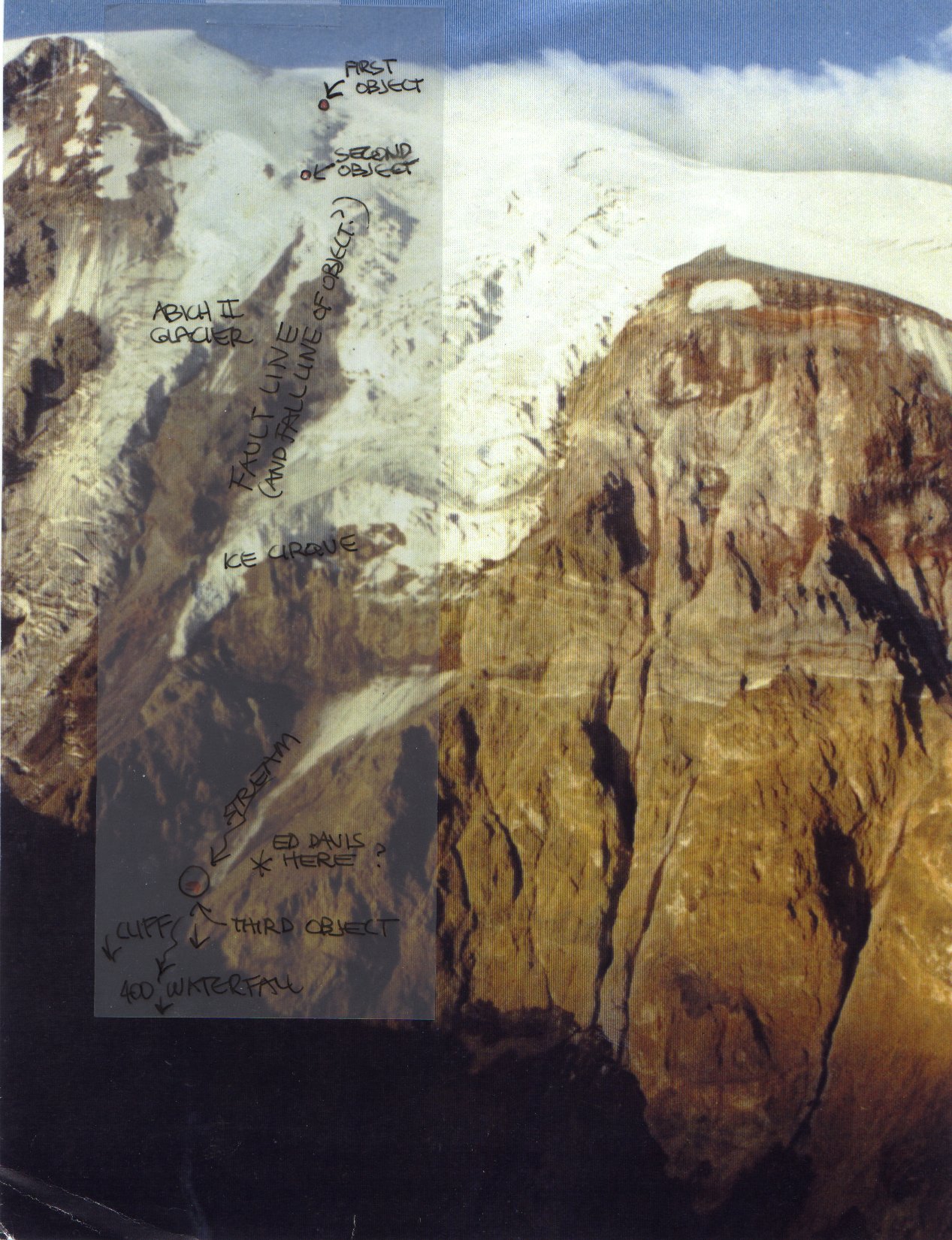 Glacial & Fault Survey
Click to Zoom
Glacial & Fault Survey
Click to Zoom
Crushing Glaciers & Volcanic Heat
Mount Ararat (Büyük Ağrı Dağı) is an active post-flood stratovolcano that erupted cataclysmically in 1840, destroying the ancient St. Jacob monastery. Massive shifting glaciers continuously pulverize rock into fine silt; no wooden structure could survive.
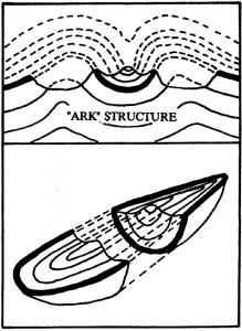 Geological Analysis
Click to Zoom
Geological Analysis
Click to Zoom
Synclines vs Structural Hulls
Geological synclines form continuous stratified bands across strata. At Durupınar, the boat formation is an isolated, double-walled hollow envelope containing internal deck walls, fossilized biological timbers, and alloy rivets.
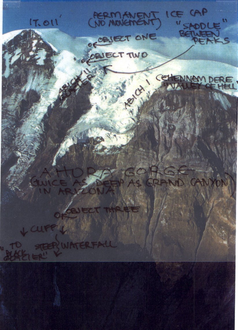 Ahora Gorge
Click to Zoom
Ahora Gorge
Click to Zoom
The "Valley of Hell" (Cehennem Dere)
Expeditions investigating Ahora Gorge encountered perpendicular 4,000-foot ice cliffs and rock avalanches. The so-called "Ararat Anomaly" is a natural basalt ledge under glacial ice.
 Expedition Mapping
Click to Zoom
Expedition Mapping
Click to Zoom
Topographic Surveys
Detailed field maps by researcher Robin Simmons document that summit anomalies lie at 16,000 feet in the shear zone of the Parrot and Abich glaciers, where human survival is impossible.
 Civilization Timeline
Click to Zoom
Civilization Timeline
Click to Zoom
Post-Flood Cultural Explosion
Historical records and archaeology document that major world civilizations (Sumer, Egypt, Indus Valley) emerge simultaneously right around 2500 BC, reflecting post-flood repopulation.
The Complete Documentary Film Archive
Watch original expeditions, subsurface radar surveys, and interviews with Ron Wyatt, Turkish scientists, and geophysicists.
Ron Wyatt's Companion Biblical Discoveries
In addition to Noah's Ark, Ron Wyatt documented physical evidence confirming key historical events of the Exodus, Mount Sinai, Sodom and Gomorrah, and the Ark of the Covenant.
1. The Red Sea Crossing (Gulf of Aqaba at Nuweiba)
 Chariot Wheel
Click to Zoom
Chariot Wheel
Click to Zoom
4-Spoke Chariot Wheel
Coral-encrusted 4-spoke, 6-spoke, and 8-spoke chariot wheels found along the underwater land bridge at Nuweiba, matching the 18th Dynasty of Egypt.
 Underwater Land Bridge
Click to Zoom
Underwater Land Bridge
Click to Zoom
Natural Underwater Bridge
Unlike the rest of the Gulf of Aqaba (over 5,000 feet deep), Nuweiba features a gentle underwater land bridge with a safe slope of only 4 to 6 degrees.
 Crossing Route
Click to Zoom
Crossing Route
Click to Zoom
Nuweiba Beachhead
The vast beachhead of Nuweiba could accommodate millions of Israelites trapped between Pharaoh's army, the mountains, and the sea.
2. The Real Mount Sinai (Jabal al-Lawz in Saudi Arabia / Midian)
 Split Rock of Horeb
Click to Zoom
Split Rock of Horeb
Click to Zoom
The Split Rock of Horeb
A 60-foot boulder split down the middle with evidence of catastrophic water erosion in an arid desert where no natural river existed (Exodus 17:6).
 Burned Peak
Click to Zoom
Burned Peak
Click to Zoom
Blackened Summit
The summit of Jabal al-Lawz is mysteriously scorched black, while the base remains brown granite. Exodus 19:18 notes: "Mount Sinai was covered with smoke, because the Lord descended on it in fire."
 Golden Calf Altar
Click to Zoom
Golden Calf Altar
Click to Zoom
Altar of the Golden Calf
Massive stone altar carved with ancient Egyptian Apis and Hathor bull petroglyphs, non-indigenous to Saudi Arabia, pointing directly to Hebrew presence.
3. Sodom & Gomorrah & The Ark of the Covenant
 Sulfur Brimstone
Click to Zoom
Sulfur Brimstone
Click to Zoom
95-98% Pure Sulfur Brimstone Balls
White sulfur nodules encased in scorched ash found at Gomorrah on the Dead Sea plain. Lab analysis confirmed 95-98% pure monoclinic sulfur—geologically unique worldwide.
 Ark of the Covenant
Click to Zoom
Ark of the Covenant
Click to Zoom
The Ark of the Covenant
Discovered in Jeremiah's Grotto beneath the Calvary escarpment in Jerusalem. An earthquake fissure directly below the cross allowed Christ's blood to drop onto the Mercy Seat below (Hebrews 9:12).
Complete Photographic Archive
Browse every high-resolution photograph, radar scan, diagram, and artifact specimen in the collection. Click any image to view in the fullscreen lightbox.